Assam-Mizoram border dispute: Fault line from history flares up in the present
New Delhi, 27 July 2021
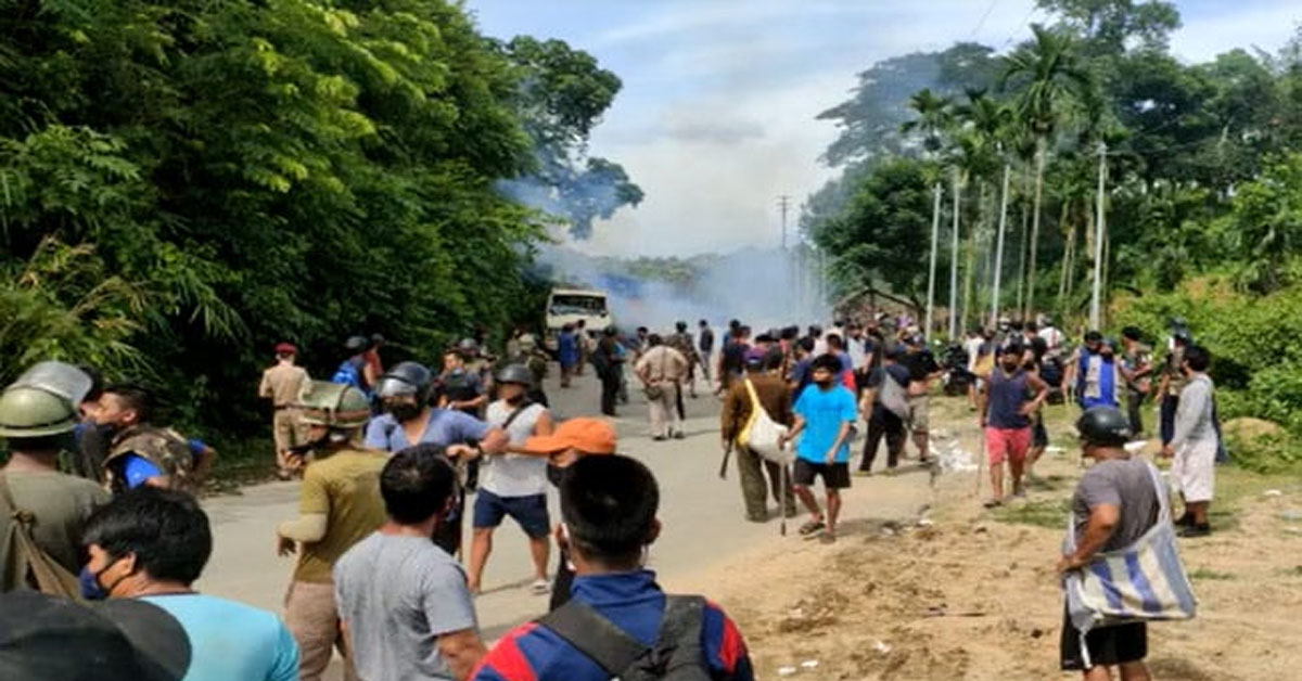
As per news report of The Indian Express, In August 1875, the southern boundary of Cachar district was issued in the Assam Gazette – the Mizos say this was the fifth time the British had drawn the boundary between the Lushai Hills and the Cachar plains, and the only time when it was done in consultation with Mizo chiefs. This also became the basis for the Inner Line Reserve Forest demarcation in the Gazette two years later. But in 1933, the boundary between Lushai Hills and the then princely state of Manipur was demarcated – it said the Manipur boundary began from the trijunction of Lushai Hills, Cachar district of Assam and Manipur state. The Mizos do not accept this demarcation, and point to the 1875 boundary which was drawn in consultation with their chiefs.
Source -indianexpress.com
If you like the story and if you wish more such stories, support our effort Make a donation.
Trending News

Sat May 30 2026 | By Newsdesk
Sat May 30 2026 | By Newsdesk
Sat May 30 2026 | By Newsdesk

Sat May 30 2026 | By Newsdesk
Sat May 30 2026 | By Newsdesk